Oct5
Scottish Country Dancing
Mon, Oct 5 · 7:00 pm
St Andrew’s Presbyterian Church 261 Christina St N Sarnia, ON

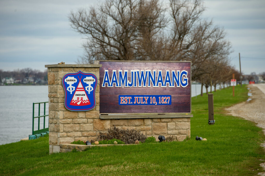
In the 1960s, governments decided it was no longer safe for people to live in the village of Blue Water beside Sarnia’s expanding petrochemical industry, and the community was dismantled and relocated. Less than a kilometre away, Aamjiwnaang First Nation, whose land had already been reduced through illegal transfer, encroachment, and coerced surrender, remained beside the same industrial corridor and continues to live with its consequences.
For a time, there was a village beside Chemical Valley.
It had houses, stores, churches, schools, and families. Workers lived there with their children. People built ordinary lives there.
Then, within the span of a few years, it was dismantled and moved.
The village was called Blue Water, and today almost nothing remains of it. What was once a community of more than two thousand residents now survives mainly in photographs, historical plaques, and the memories of the people who grew up there.
Blue Water is often remembered as a vanished wartime village. But its disappearance also reveals something else, governments already knew, decades ago, that living beside the expanding petrochemical corridor carried risks they were no longer willing to accept.
Blue Water was created quickly and deliberately. The village was established in 1942 during the Second World War, when Canada built a synthetic rubber plant in Sarnia after wartime supply disruptions cut off access to natural rubber from Southeast Asia. Workers flooded into the region to construct and operate the Polymer plant, and housing had to be built just as quickly.
According to the Sarnia Historical Society, the settlement began with temporary barracks and bunkhouses for workers before growing into a permanent community. By 1956, the village contained 575 homes and 26 businesses, with a population of 2,322 residents.
The community included stores, churches, and schools. For the families who lived there, Blue Water was simply home.
But from the beginning it occupied an uncertain place in the region. Although located beside Sarnia’s industrial corridor, Blue Water was never fully integrated into the city’s infrastructure system. The Sarnia Historical Society notes that the village looked to Sarnia for improvements such as paved roads and sewer service, but those requests were denied. Blue Water had water service and street lighting, but its roads remained gravel and the community never received a sewer system.
In effect, the village existed beside the city rather than fully within it, close enough to house workers for Chemical Valley, but without the same level of municipal investment seen in other neighbourhoods developing during the postwar period.
By the early 1960s, the landscape around Blue Water had changed dramatically. Chemical Valley was expanding rapidly. Refineries and petrochemical plants were being built across the area, and the industrial corridor increasingly surrounded the village itself.
Local officials began to question whether people should continue living there at all.
Historical accounts describe discussions about whether the community would become “a hindrance to future industrial growth” and whether residents should remain living so close to industrial operations.
The decision that followed was extraordinary. Governments concluded that Blue Water should be dismantled and its residents relocated.
According to the Sarnia Historical Society, the relocation of 592 families was estimated at $5.5 million, with federal funding helping to support the move. Polymer purchased 130 acres in 1964, and the final expropriations followed in 1966.
Blue Water was gone. The reason was straightforward, officials had concluded that living there was no longer safe.
Less than a kilometre away, another community remained.
Aamjiwnaang First Nation had lived along the St. Clair River long before Chemical Valley existed. But by the time Blue Water was built, the territory of Aamjiwnaang had already been significantly reduced.
According to Aamjiwnaang First Nation’s modern historical account, the community originally held approximately 10,280 acres. Over time, much of that land was lost through treaties, encroachment, and unlawful or coercive transfers.
One example occurred in the 1840s, when a tract of land one mile wide and four miles long on the east side of the reserve was transferred to land speculator Malcolm Cameron. Aamjiwnaang’s historical account describes this transfer as an illegal transaction that bypassed legal requirements governing reserve land sales.
Later expansions of the Town of Port Sarnia reduced the reserve by another 1,257 acres.
Then came the Oliver Act.
After the Indian Act was amended in 1911, reserve lands near growing cities could be expropriated for public purposes. In 1919, Sarnia sought 1,184 acres of Aamjiwnaang land for a proposed steel plant. Two surrender votes failed. According to the community’s historical account, the city then threatened to use the Oliver Act to expropriate the land, and a third vote passed under that pressure.
By the time Blue Water was built in the 1940s, Aamjiwnaang had already lost much of its original territory through these processes.
And when Blue Water was dismantled in the 1960s because of safety concerns, Aamjiwnaang was not relocated.
The First Nation remained where it was, on land that had been its home long before the surrounding industrial corridor existed.
The story did not end in the 1960s.
Aamjiwnaang still sits beside Chemical Valley, one of Canada’s largest petrochemical clusters. Investigative reporting has described the community as living on the industrial fenceline, with homes located within a short distance of dozens of industrial facilities.
Recent events illustrate how immediate those impacts can be.
In April 2024, after a benzene release linked to a nearby petrochemical plant, Aamjiwnaang First Nation declared a state of emergency. Reuters reported that at least 10 residents sought hospital treatment, and federal officials later introduced stronger pollution controls affecting facilities in the Sarnia area. Canada’s environment minister said it was unacceptable that communities in the region, particularly Indigenous communities, continued to face the effects of industrial pollution.
The federal government later extended the emergency order regulating emissions from the facility.
Blue Water is often remembered as a vanished village from Sarnia’s industrial past.
But it also shows something about how that past unfolded.
By the 1960s, governments had concluded that living beside the expanding petrochemical corridor posed unacceptable risks for the residents of Blue Water. The solution was to dismantle the village and relocate its families.
Less than a kilometre away, Aamjiwnaang remained.
The First Nation had already lost significant portions of its territory through illegal transfer, encroachment, and coercive surrender pressure. Industrial development then expanded around the remaining land, creating the petrochemical corridor that still surrounds the community today.
The history of Blue Water does not suggest that Aamjiwnaang should have been moved as well. Aamjiwnaang is living on its own ancestral territory.
What the story shows instead is how the landscape around that territory changed.
A workers’ village built for industry could be dismantled once officials decided its location had become unsafe. An Indigenous community whose land had already been constrained remained where it was as the industrial corridor expanded around it.
That contrast is part of the history of Chemical Valley.
And it is part of the history of Sarnia itself.
Mon, Oct 5 · 7:00 pm
St Andrew’s Presbyterian Church 261 Christina St N Sarnia, ON
Tue, Oct 6 · 5:30 pm
The Bridge Patisserie Café 12 Michigan Ave Point Edward Point Edward, ON
Tue, Oct 6 · 6:00 pm
Black Gold Brewery 395 Fletcher St Petrolia, ON